Plan Submissions Online (PSO)
Overview
A web-based plan submission and checking tool built for Saskatchewan Information Services Corporation (ISC) which auto-verifies business rules before submitting to Plan Processing.
Business Challenge
Saskatchewan Information Services Corporation (ISC) required a workflow to support the submission of digital survey plans by Saskatchewan land surveyors. They wanted an application that would eliminate the need for forms and paperwork and that would ultimately advance their service delivery. They also identified that the tool must help improve the quality of submitted survey plans in order to reduce the number of rejections, making the whole process efficient for everyone.
Solution
Building upon the success of the Survey Plan Online Checker (SPOC) application for Alberta Land Titles, MNC began the development of a solution for ISC which leveraged functionality from the original project, making it a unique CotS+ (Commercial-off-the-Shelf) solution.
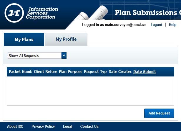
The new web application, called Plan Submission Online (PSO), allows digital survey plans to be submitted online and pre-screened prior to acceptance by the ISC. PSO allows you to enter, check and store plans of survey and descriptive plans online before submitting them for examination and approval. Essential data is validated as it is entered, helping the user ensure all necessary information and support documents have been provided. The application improves the quality of submitted survey plans by performing various checks prior to submission (e.g. CAD layers, geo-referencing, dimension annotation). It also validates location and allows the user to visually confirm the plan against the cadastral mapping base for Saskatchewan and surrounding plans when submitted with a CAD file.
Additional system features include:
- Checks to confirm parcel closures
- Checks for required survey elements, such as the north arrow, to confirm that the surveyor has included these elements on the plan
- Summary of file analysis
- Iterative checks with results reported to the surveyor until the CAD file passes the required quality reviews (prior to the package being submitted to ISC)
- Checklists for the plan examiners, summarizing the finalized automated quality tests performed
- Creation of a submission package and confirmation that the required associated documents for registration are contained in it for registration
- The ability to associate supporting documents to a plan
- Extraction of relevant information from the CAD file and supporting documents to be used to populate the PITS (Plan Index & Tracking System) database
- Performance of spatial queries to extract information based on location
- Conversion of all documents to standardized TIFF format and the creation of associated thumbnail images
- The ability for some plans to be submitted for information purposes only and not be required to be passed through PSO depending on their type (e.g. bridge plans, historic plans not in the Land Surveys Directory)
- Transfer of data utilizing web services
Benefits
- Reduced Errors & Costs: By identifying survey plan errors prior to plan registration, there is the potential cost savings and helps improves the reliability and confidence in the land registration process.
- Improved Quality: All files processed through PSO are verified that the digital CAD file is geo-referenced, as well as new checks to confirm parcel closures or that required survey elements (such as the north arrow) are included.
- User-friendly: The system alerts surveyors if any necessary plan information is missing or appears to be incorrect.
- Visual Checks for Users: A surveyor can view their plan relative to the complete and current cadastral fabric for Saskatchewan and enables them to identify plan anomalies or conflicts prior to submission.
- Faster Approvals: The digital workflow helps streamline the approval process and improves the overall quality of the registration documents.
- Reduced Effort: ISC staff can focus their efforts on registering documents instead of verifying files match submission requirements.
- More Secure: The system compresses and encrypts the surveyors digital plan package making it secure; only ISC staff can extract the information in this package for plan registration purposes.
- More Information: Metadata is verified by users and assists in automating subsequent approval and mapping workflows such as unit counts and location information.