2010: Survey Plan Online Checker (SPOC) for Alberta
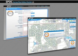
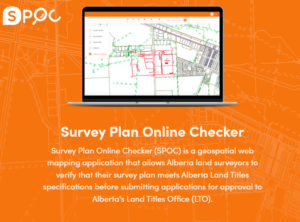
Survey Plan Online Checker (SPOC) is a geospatial web MAP application that allows Alberta land surveyors to verify that their survey plan meets Alberta Land Title specifications before submitting applications for approval to Alberta’s Land Titles Office (LTO).
SPOC imports a survey plan CAD file and performs various business rule checks to validate contents, spatial integrity, and formatting. Once the CAD data meets or exceeds quality parameters, SPOC packages validated data, the corresponding survey plan image, and relevant metadata into a digital submission package. The package is then submitted to LTO by surveyors in conjunction with their survey plan registration request.
The Challenge
Due to reduced budgets at Service Alberta in 2009, Alberta Land Titles Office (LTO) resources were drastically reduced, strengthening the desire for efficiencies from a digital workflow. LTO wanted a system to assist them in checking digital CAD files submitted for plan registration, performing a series of automated checks to verify a CAD file complies with submission specifications, including having appropriate CAD layers, geo-referencing, and dimension annotation. Since the CAD file is the source for the survey plan to be registered, checking the CAD file results in higher quality survey plans.
MNC was engaged by the Government of Alberta to build a geospatial web map application that would allow Alberta land surveyors to verify that their survey plan meets Alberta Land Title specifications before submitting applications for approval to LTO. An online application would ease their resource constraints.

The Solution
MNC developed Survey Plan On-Line Checker (SPOC); a custom geoprocessing service that imports a CAD file and performs various business rule checks to validate its contents and formatting and then provides a package that is ready for submission to the LTO. The solution involved working with software from Bentley, Autodesk (AutoCAD), Esri (ArcGIS), and Safe Software (FME).
The Results
- Improved Quality: All files processed through SPOC are verified that the digital CAD file is georeferenced according to Director of Surveys requirements.
- Visual Checks For Users: A surveyor can view their plan relative to the complete and current cadastral fabric for Alberta which enables them to identify plan anomalies or conflicts prior to submission.
- Faster Approvals: The digital workflow helps streamline the approval process and improves the overall quality of the registration documents.
- Reduced Effort: LTO staff can focus their efforts on registering documents instead of verify files match submission requirements.
- More Secure: The system compresses and encrypts the surveyors digital plan package making it secure; only LTO staff can extract the information in this package for plan registration purposes.
- More Information: Metadata fields regarding the CAD file, such as the survey method and datum to assist in the registration and mapping process, are also captured by the system.
- Reduced Errors and Costs: By identifying survey plan errors prior to plan registration, there is the potential cost savings of more than $2,000 per plan and helps improve the reliability and confidence in the land registration process.


