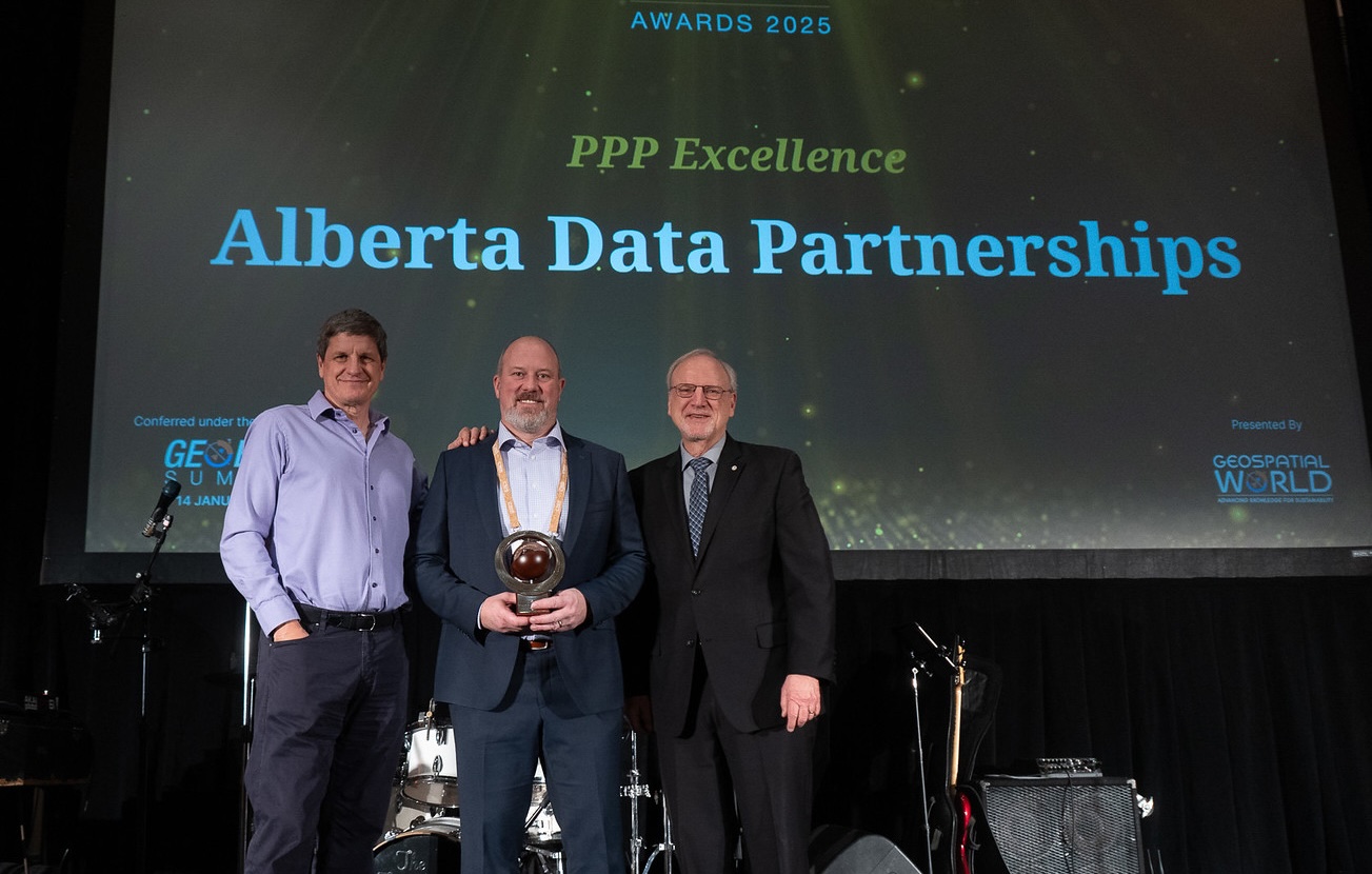
Alberta Data Partnerships attended the GeoBUIZ Summit 2025
Erik Holmlund, the Executive Director of ADP, participated in a panel session, during which he described the unique P3 business model that we have had in place for almost 30 years at ADP. He also highlighted the work of our joint venture partner Altalis Ltd., as well as our contractors, MNC (Martin Newby Consulting Ltd.) and AbaData.
Alberta Data Partnerships was also given the award for PPP Excellence. It was an honour to accept the award on behalf of our partners, stakeholders and Board Members: Government of Alberta, Alberta Energy Regulator (AER), Canadian Association of Petroleum Producers (CAPP), Alberta Chamber of Resources, Alberta Forest Products Association, TELUS, ATCO Gas, FortisAlberta, Alberta Municipalities | Strength in Members, Rural Municipalities of Alberta and Utility Safety Partners.
Public Private Partnerships (P3’s)
Public Private Partnerships (P3’s) are essentially long-term partnerships whereby one or more private sector firms partner with a government to build, own and operate infrastructure or a service that would historically be a government responsibility. There are many different types and models for P3’s with a variety of investment, funding, contractual or franchise and governance mechanisms employed.
MNC is thrilled to continue our collaboration with AltaLIS as part of the P3 Partnership in Alberta. Since reengineering the Provincial Cadastral Survey dataset in 1998, we’ve developed innovative solutions like Title Mapping and DIDs Mapping. We’re excited about the opportunities ahead and eagerly anticipate what the future holds.
In 1995, the Government of Alberta consulted with key data users in Alberta and subsequently formed the Spatial Data Warehouse (SDW), now the Alberta Data Partnerships (ADP) steering group. This group was tasked with dealing with the problems public and private sector users of mapping data were facing, including finding innovative approaches to funding and sustainability of the datasets.
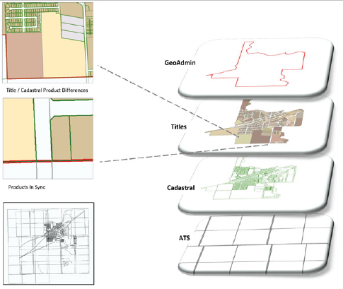
In 1998, Altalis was selected as the operating partner responsible for operations, and MNC was selected as the contract service provider. Since then, MNC has created and maintained the following province-wide datasets: Cadastral, Titles and Enhanced Titles, Dispositions (DIDs and DIDs +), Alberta Township System (ATS), and the GeoAdmin.
Cadastral Data
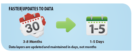
A filing fee model was established to ensure sustainable cadastral data maintenance independent of government budgets. This system efficiently integrates surveyor-provided CAD data into a mapping base, reducing costs and improving accuracy.
Title Mapping and Enhanced Title Mapping
The development of the titles mapping database involved designing a spatial database including the “linc” number and legal descriptions for each title, converting historical textual metes and bounds into a graphical format, integrating title information into the cadastral map fabric, and constructing title polygons based on the title “extent.”
Dispositions – DIDs and DIDs +
The Government of Alberta expressed interest in mapping dispositions in a CAD format similar to the cadastral base. Ideally, these would be in GIS format akin to the title mapping initiative. Desired outcomes included a significant reduction in manual labor, administrative, and copying costs; streamlining the submission process through a standardized digital filing method; and creating a singular definitive mapping layer and dataset for dispositions, accessible to all stakeholders active on Crown Lands.