2017 ParcelMap BC – Survey Plan Submissions (SPS) Website
Survey Plan Submissions (SPS) is a web-based application designed to support operational maintenance of the ParcelMap BC parcel fabric. It leverages Esri’s ArcGIS for Server technology and Safe Software’s FME.
To support sustainability, BC land surveyors are required to submit their survey plan datasets to LTSA as part of the mandatory process for plan package submissions. Surveyors submit their datasets through SPS; an innovative web map application that runs custom geoprocessing services to perform various business rule checks that validate their digital survey plan quality online.
Surveyors use AutoCAD (or other CAD programs) to create the registered survey plan image, which is an official plan of record for plans in BC. Traditionally, digital parcel fabrics could be maintained by having technicians re-draw the survey plan using various coordinate geometry (COGO) techniques. SPS eliminates the need for redundant redrawing (i.e., CAD –> paper –> GIS).
The ParcelMap BC Operations Team can now integrate newly surveyed digital and geo-referenced parcels and control points from the survey plan (i.e., CAD file) directly into the parcel fabric. Because these plans are geo-referenced, the overall spatial accuracy of the ParcelMap BC fabric can be improved.
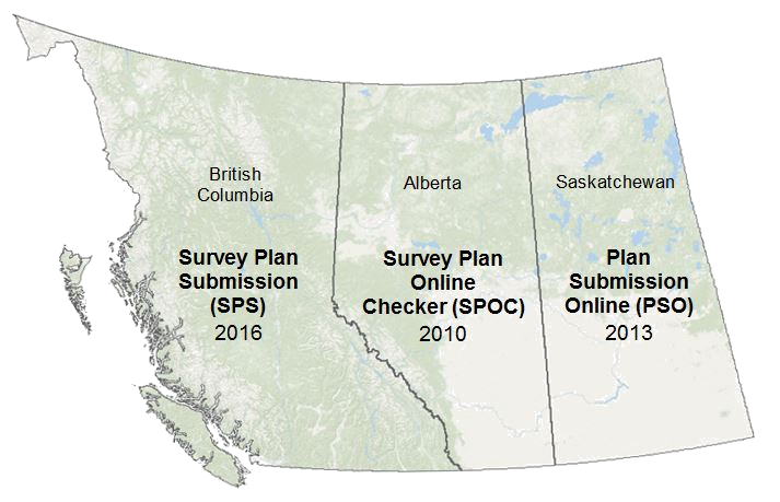
SPS was built on the success of the SPOC application built for Alberta in 2010 and the Plan Submission Online (PSO) application built for Saskatchewan in 2013.
The Solution
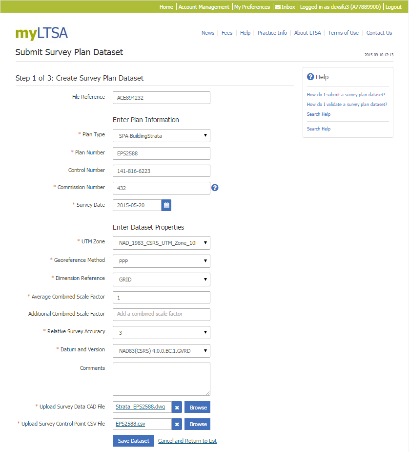
Step 1: Create a New Dataset
To submit their survey plan datasets in SPS, surveyors must first create a new dataset and enter/upload the following information into the application:
- Metadata (e.g., Survey Date, UTM Zone, etc.)
- Survey data in the form of a CAD file (.dwg format)
- Control point data in the form of a CSV file
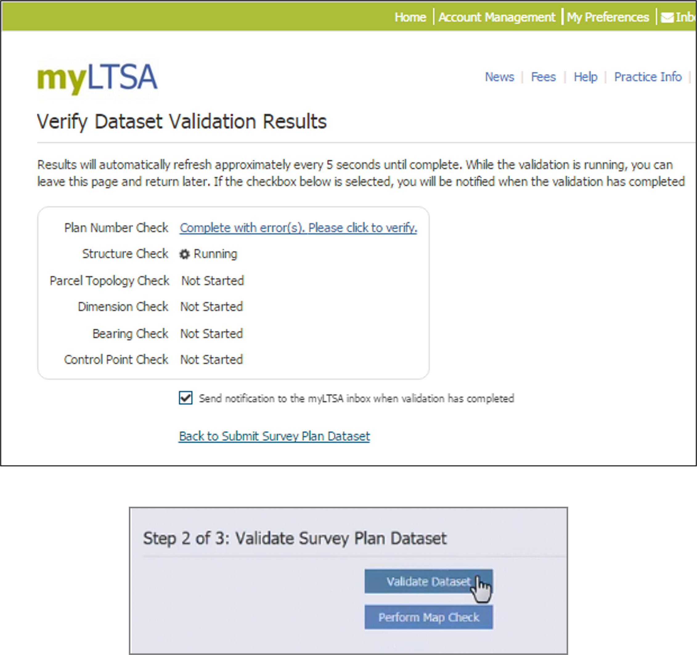
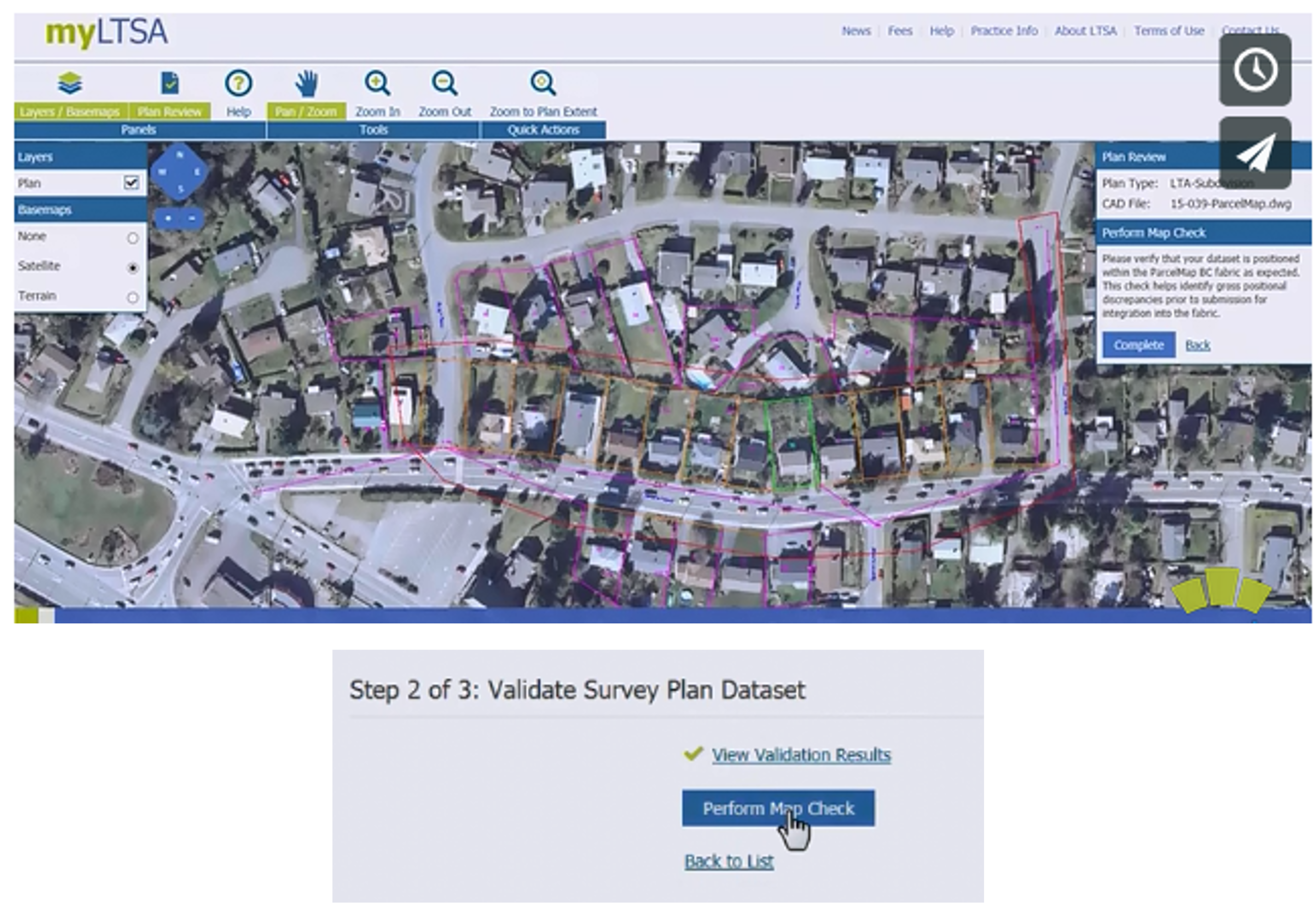
Step 2: Validate the Dataset
A number of business rules are checked to validate the integrity of data provided and report any errors, including:
- Plan Number Check
- A plan number which is not assigned for the entered commission number
- A plan number which is already in use or not assigned
- Structure Check
- Missing Layer, Invalid CAD file, 3-D CAD, CAD not in Model Space
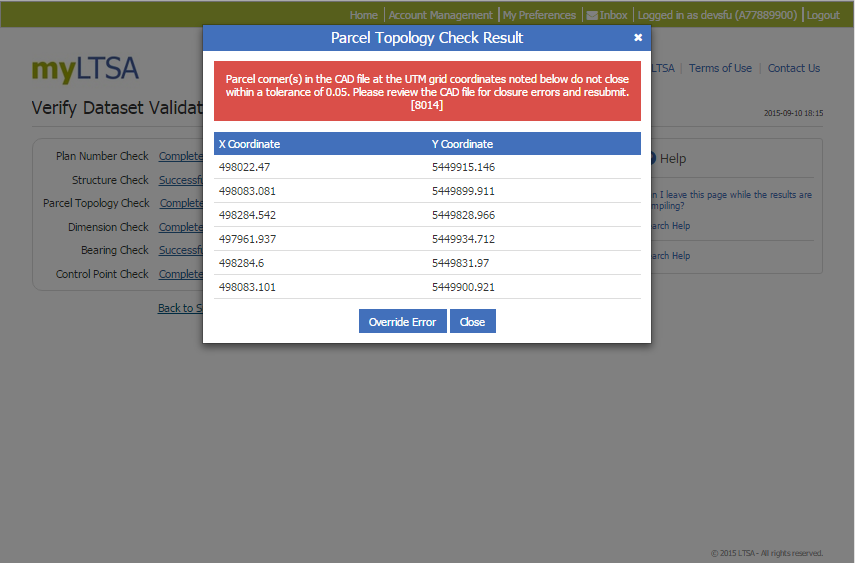
- Parcel Topology Check
- Parcel corner(s) do not close within a tolerance of 0.05
- Control Point Check
- Missing or wrong Record Separator
- Missing Description
- Not Enough Control Points
Parcel Topology Check Result
Example of messaging back to user – problem with topology – the line work on a specific layer does not created closed shape as expected – coordinates for the user to review CAD file easily.
Perform a Map Check
Surveyors perform a visual check to ensure the plan is correctly positioned within the ParcelMap BC fabric.
Visual confirmation of geo-referencing and surround of their area of interest.
Esri JavaScript API is used to create the map user interface (basic functions– pan, zoom, display the map). Esri ArcGIS Enterprise map services is used to display the map data, such as the parcel fabric under the CAD file.
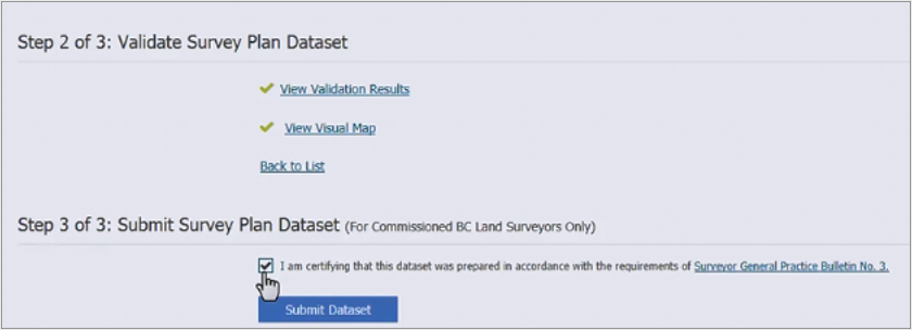
Step 3: Submit the Dataset
Only registered land surveyors may submit survey plan datasets.
The Results
- Reduced Errors & Costs: By identifying survey plan errors prior to plan registration, costs are reduced through automated checks and any associated costs for resubmission or corrections
- Improved Quality: All processed files are verified to ensure compliance with geo-reference requirements parcel closures or other survey elements are included
- User Friendly: The system alerts surveyors if any necessary plan information is missing or appears to be incorrect, guiding the process before final submission
- Visual Checks for Users: Users can view their plan relative to the cadastral(parcel) fabric and identify any plan anomalies or conflicts prior to submission
- Faster Approvals and Improved Quality: Digital workflows help streamline the approval process and improves the overall quality of the registration documents through automated business rule checks and validation
- Reduced Effort: Registry staff can focus their efforts on registering documents instead of verifying that files match submission requirements
- More Secure: The system compresses and encrypts the surveyor’s digital plan package, ensuring only authorized staff can extract the information in this package for plan registration purposes
- More Information: Metadata is verified by users and assists in automating subsequent approval and mapping workflows such as unit counts and location information