1998: Alberta Cadastral Mapping
MNC Re-engineered Cadastral mapping for the Province of Alberta using Bentley (MicroStation), Autodesk (AutoCAD), Safe Software (FME), and Esri (ArcGIS). MNC continues to maintain this dataset today; 26 years later and over 210,000 survey plans integrated.

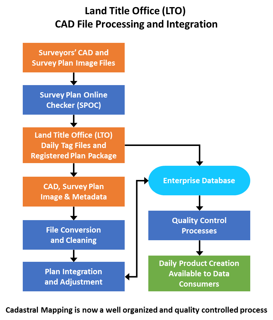
The Challenge
In 1995, there were significant demands by users to improve the quality, timeliness, and accuracy of Alberta’s cadastral data and to reduce the cost of the various map products in Alberta. The cadastral maintenance process was onerous and consisted of an inefficient digital-to-paper-to-digital conversion.
The Solution
MNC undertook the following:
- Funded and built new processes for data loading, maintenance, storage, and distribution
- Developed new software for plan integration and quality control
- Converted and updated the datasets
- Designed and implemented a state-of-the-art IT infrastructure for loading, storage, security, and distribution of cadastral data
- Provided training to end-users
- Provided support services to allow surveyors to submit plans digitally as part of the normal filings at the Land Titles Office (LTO)
- Great effort was expended in the development of the integration engine and related processes to:
- Improve accuracy;
- Eliminate issues of benching and breaks; and
- Maintain the relative accuracy and integrity of the survey.
- Integration of the process with Land Titles was critical as the government was using this initiative to:
- Move to an entirely digital filing process; and
- Provide enhanced online access to digital title records plus all historical records (which were scanned for online retrieval).
The Results
In less than one year, MNC was able to demonstrate the following improvements:
Reduced costs:
- Operational data maintenance and management costs ($5.9 Million in today’s dollars) to the Government of Alberta were eliminated
- The total cost to maintain the data was significantly reduced
- All costs are now borne by the entity creating change or using the data
- Creation of a sustainable financial model
Faster turnaround in data creation, maintenance, and distribution:
- Updates are now available between 1 and 7 days from the time a plan is registered at the Land Titles Office. This is down significantly from the original 2 to 8 months
Improved accessibility:
- Data order and access was modernized to an online system cutting the wait time from 2 to 6 weeks to real-time (i.e. data is delivered within seconds of the request)
Data accuracy significantly improved:
- MNC continuously improves the quality and accuracy of the entire mapping fabric and database as new plans are added and integrated
- MNC created an “intelligent” digital dataset from the old “dumb” graphics mapping at no cost to the Government of Alberta