Modernizing Land Administration with GeoAI-Ready Cadastral & Parcel Intelligence

Empowering governments and land administrators with automated, accurate, and intelligent parcel data for the future of land management.

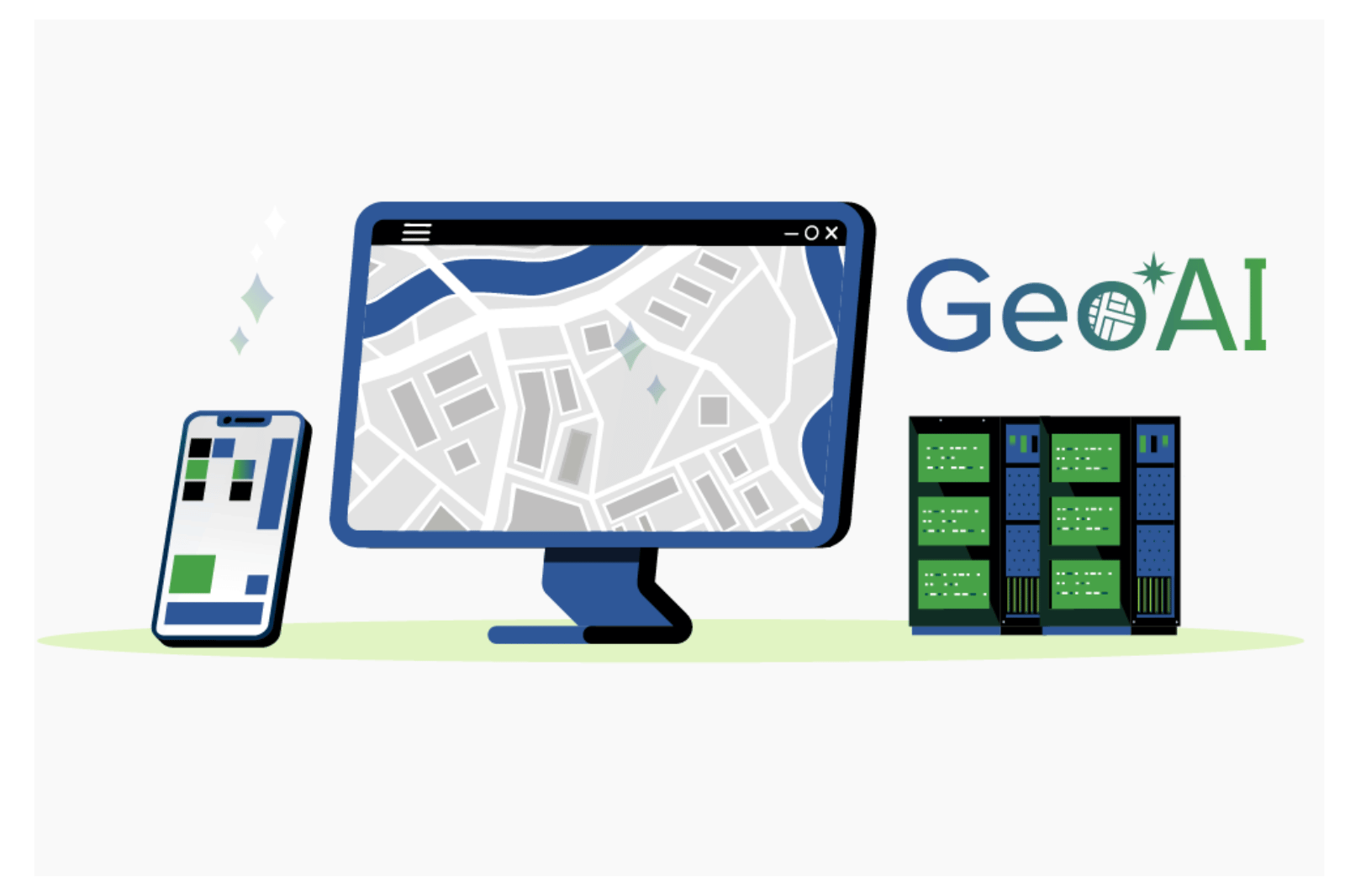
GeoAI-ready parcel mapping platform displayed across desktop, mobile, and cloud-based data systems
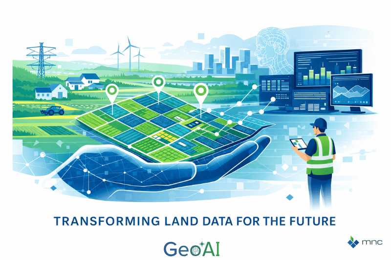
Illustration of connected land data systems supporting parcel fabric modernization and geospatial analytics

Transforming Land Data for the Future

You manage land data that supports thriving communities. However, manual processes and static records can slow progress. Modernizing with intelligent, AI-enabled systems is now essential for enhancing accuracy, efficiency, and trust.

MNC partners with governments, land authorities, and land departments to deliver the next generation of parcel fabric and cadastral data solutions.

Why GeoAI, and what does it mean to be GeoAI Ready?

  • GeoAI merges GIS and artificial intelligence to transform how you manage, map, and monitor land.

  • Your foundational parcel data is accurate, standardized, and ready for smart automation.

Unlock reliable, efficient, and transparent land management by partnering with MNC.
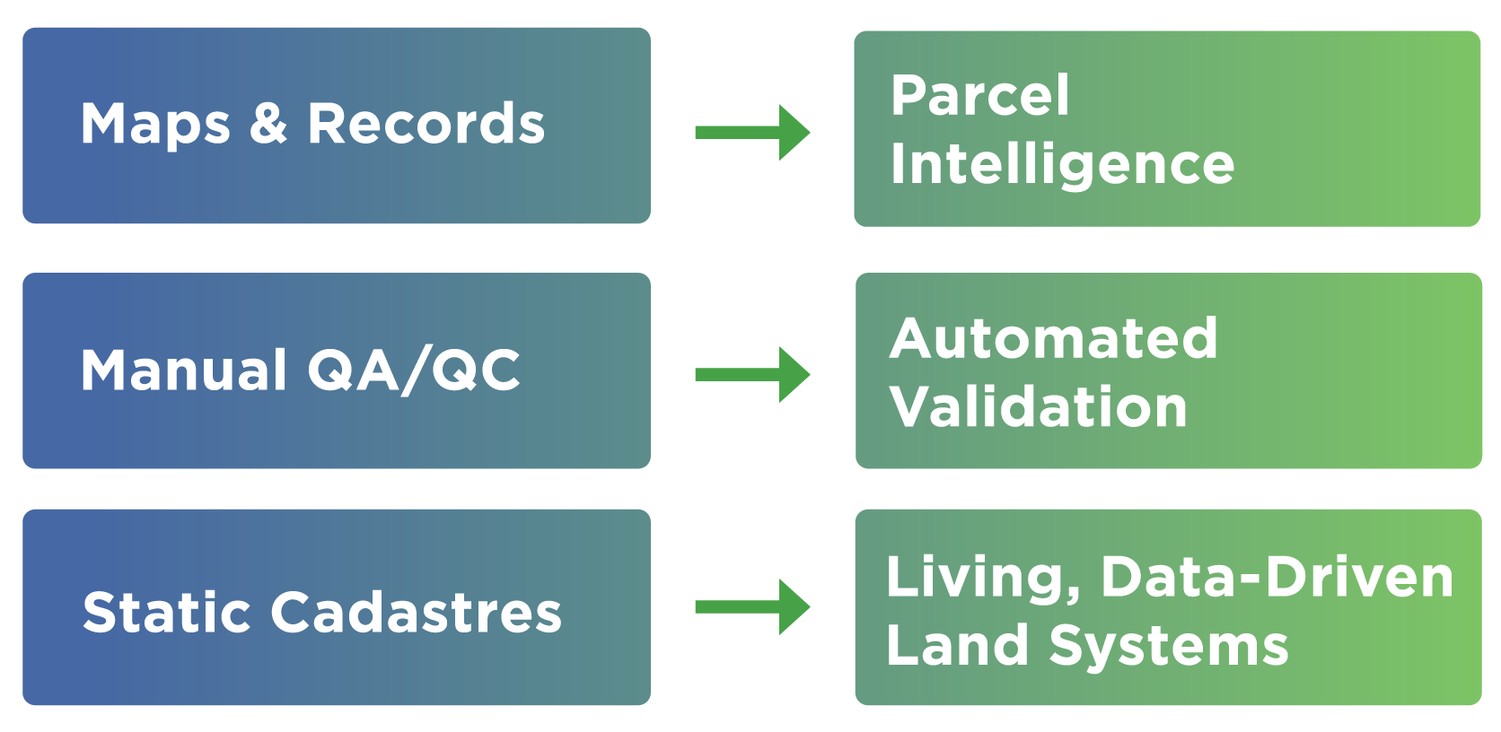
Diagram showing transition from manual GIS processes to AI-driven parcel intelligence, automated validation, and data-driven land systems

What GeoAI Delivers and What Organizations Gain:

Automated mapping and validation

Streamline parcel mapping, validation, and data updates with intelligent, automated workflows.

Rapid change detection

Quickly identify boundary shifts, new developments, and land use changes using satellite or survey data.

Consistent, high-quality data

Apply AI-driven checks to maintain accuracy, consistency, and compliance with data standards.

More efficient workflows

Accelerate routine processes and improve turnaround times from data collection to decision-making.

Predictive insights for better planning

Deliver predictive insights and spatial analysis to guide planning, investment, and regulatory decisions.

Public transparency

Power clear, up-to-date land information systems that build trust and enable faster service delivery.

MNC GeoAI grphic depicting core capabilities using GeoAI

About MNC and Our Core Capabilities

MNC has supported government land authorities for over 25 years, delivering enterprise-scale cadastral and parcel systems across Canada, the USA, and the Caribbean.

We specialize in transitioning legacy cadastral environments into modern, GeoAI-ready parcel fabric ecosystems—ensuring authoritative land data is accurate, governed, and future-ready.

What We Deliver

  • Parcel Fabric Modernization & Management
  • Integration of GIS parcels with registry and assessment systems
  • Automated QA/QC and validation workflows
  • FME-driven geospatial automation
  • Enterprise GIS integration and cloud-ready systems

Our work strengthens authoritative land data foundations, reduces operational risk, and prepares land systems for intelligent automation.

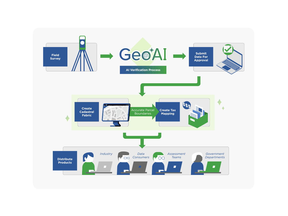
Diagram depicting the workflow from data collection to system integration and informed decision-making

Why MNC Is Trusted by Land Authorities

MNC operates at the intersection of cadastral science, GIS modernization, and GeoAI-ready data governance.

Our Advantage

  • 25+ years of cadastral and parcel leadership
  • Esri Gold & Cornerstone Partner with Parcel Management and State and Local Government Specialties
  • Deep expertise in parcel fabric design and governance
  • Proven QA/QC automation pipelines
  • Cloud-ready, enterprise-scale land systems
  • Integrated with Altalis, Silvacom CS, and the Silvacom Group

We specialize in cadastral and parcel systems, helping land authorities modernize without disrupting operations while building trust in authoritative data.
The MNC GeoAI Value Framework

Authoritative Data → Modern Systems → Parcel Intelligence
Data Quality:

Accurate parcel data forms the foundation for AI workflows.

Workflow Speed:

Automate QA/QC for faster operations.

System Upgrade:

Modernize GIS for GeoAI readiness.

Trust Building:

Strong governance enhances record confidence.

Future Intelligence:

Predictive insights support proactive administration.

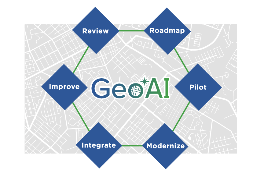
The MNC GeoAI Adoption Journey

Parcel & Data Readiness Review
Parcel Fabric Modernization Strategy
Automation & QA/QC Pilot
Enterprise GIS Modernization
GeoAI Integration
Improve, Scale & Govern
Diagram showing GeoAI adoption journey from readiness review and modernization to integration, scaling, and continuous improvement

Frequently Asked Questions

What is GeoAI?

GeoAI combines geographic information systems (GIS) and artificial intelligence. It applies AI techniques, including machine learning, computer vision, and pattern recognition, to spatial and land data, enabling automated mapping, predictive analysis, and intelligent data validation that would be impractical to perform manually.

Being GeoAI-ready means your foundational land and parcel data is accurate, standardized, and structured in a way that AI systems can work with effectively. It typically requires clean parcel fabric data, consistent attribute schemas, and a GIS platform capable of supporting AI-driven workflows, such as ArcGIS Pro. MNC's Parcel & Data Readiness Review is the fastest way to find out where your organization stands.

Traditional GIS relies on human operators to interpret, analyze, and update spatial data. GeoAI adds automation and intelligence, the system can detect anomalies, recognize patterns, classify features, and generate predictions without manual intervention at every step. Think of GIS as the foundation and GeoAI as what makes that foundation continuously self-improving.

The most common applications include automated QA/QC validation of survey plans and parcel boundaries, intelligent extraction of data from scanned historical maps and documents, rapid change detection for boundary updates and new developments, and predictive analytics to support land use planning and dispute resolution. Each delivers measurable time and cost savings over manual approaches. 

Most organizations benefit from beginning with a Parcel & Data Readiness Review. MNC assesses the current state of your data, identifies data quality gaps, and builds a clear prioritized roadmap before any AI tools are deployed. This avoids the common and costly pitfall of applying AI to unreliable data.

Parcel data quality is the single most important factor in GeoAI performance. AI models trained or run on inconsistent, incomplete, or topologically incorrect data will produce unreliable outputs, regardless of how sophisticated the AI itself is. MNC's GeoAI adoption journey always begins with a data readiness assessment because clean, standardized parcel data is the non-negotiable prerequisite. 

Change detection is one of the highest-value GeoAI applications for land administration, automatically identifying boundary shifts, new subdivisions, land use changes, or discrepancies between registered records and current on-the-ground conditions. This significantly reduces the manual effort required to keep cadastral records current and accurate.

MNC structures GeoAI adoption as a progressive phased journey: beginning with a Parcel & Data Readiness Review, then Parcel Fabric Modernization Strategy, Automation & QA/QC Pilot, Enterprise GIS Modernization, GeoAI Integration, Predictive Model Testing, and finally Scale & Govern. This phased approach ensures organizations build on solid data foundations before deploying AI-driven tools. 

Perfection is not required to begin. GeoAI can deliver incremental benefits even in environments that are not yet fully mature. The most impactful results come when AI operates on modern parcel fabrics, clean data models, and strong governance. MNC helps organizations identify where they are on the maturity spectrum and prioritize the improvements that unlock the greatest GeoAI value. 

MNC integrates GeoAI capabilities such as automated feature extraction, spatial anomaly detection, and intelligent plan validation directly into custom applications. SPOC, MNC's Survey Plan Online Checker, uses automated spatial QA/QC logic that reduced manual review time for Alberta Land Titles by 90%. New builds increasingly incorporate machine learning models for pattern recognition, boundary classification, and predictive land analysis.

→ Arrange your Parcel & Data Readiness Review: mncl.ca/contact/

→ Explore MNC GeoAI services: mncl.ca/services

Ready to Prepare Your Land Systems for GeoAI?

Most organizations begin with a focused assessment of parcel fabric readiness, data quality, automation opportunities, and modernization gaps.


GeoAI Logo