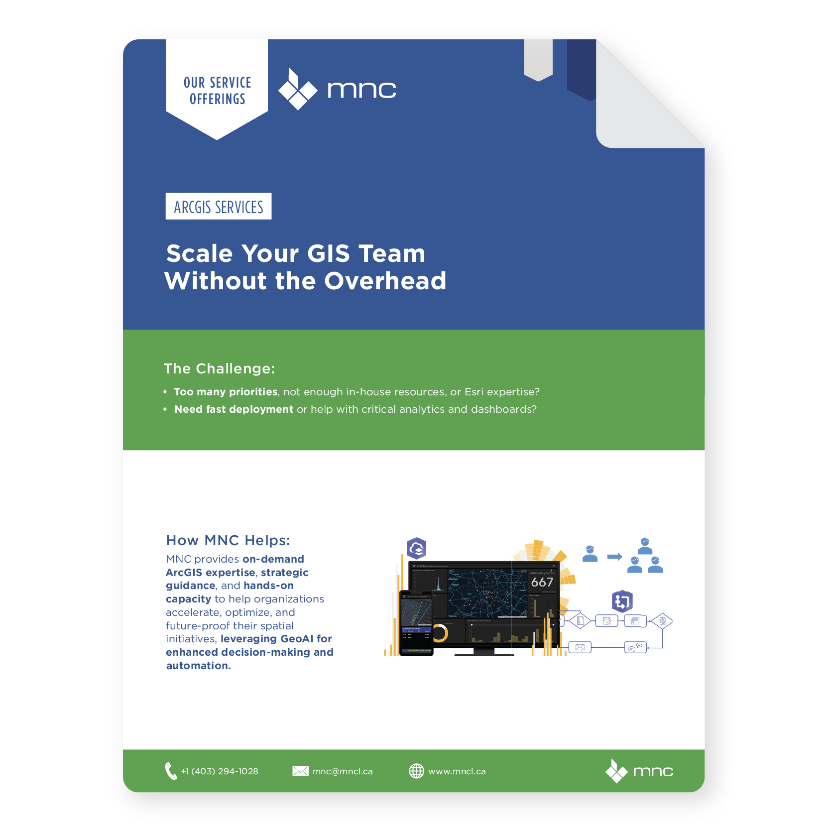
Is your organization stretched thin, with valuable projects sidelined due to limited in-house resources?
MNC’s ArcGIS Services help land administration organizations maximize the value of their Geographic Information System (GIS) investments, even when internal resources are limited or bandwidth is stretched thin.
Our team of Esri Gold Partner GIS professionals and seasoned developers fill critical resource gaps, provides strategic guidance, and helps your ArcGIS projects deliver lasting value to your organization.
Collaborating with MNC has been an excellent process for us. MNC’s project management and clear communication approach made it easy for us to evaluate options and make informed decisions. They were quick to problem-solve and let us know the options and the impact of each.
MICHELLE ST. CLAIR,
Project Lead, Barbados Lands & Surveys Department
MNC’s expertise has resolved complex data alignment issues and prepared us for future parcel mapping challenges. MNC’s tailored solutions and strategic insights have significantly improved our service delivery, ensuring that our Ontario Parcel information remains reliable. Their commitment to excellence resonates well with our goals at Teranet, making this collaboration a key component of our success.
David Hendry,
Senior Manager, Ontario Parcel at Teranet
The efficient and timely compilation and maintenance of our data products is key to ensuring that our stakeholders receive the data they need for critical business decisions. MNC has proven for over twenty-five years that they are able to provide this service through their engagement as a contractor to the ADP-Altalis Joint Venture.
Erik Holmund,
Executive Director at Alberta Data Partnership Ltd.
MNC's ArcGIS Services give land administration organizations access to expert GIS capacity on demand. If your internal team is stretched thin, lacks specific expertise, or has a growing backlog of GIS projects, MNC's Esri Gold Partner professionalsstep in to configure, develop, and maintain ArcGIS solutions tailored to your land management needs, acting as an extension of your team.
Does MNC work with ArcGIS Online or ArcGIS Enterprise — or both?
MNC configures, deploys, and supports both ArcGIS Online (Esri's cloud-hosted platform) and ArcGIS Enterprise (on-premises or private cloud). The right choice depends on your security requirements, connectivity, and existing IT infrastructure. MNC assesses your environment, recommends the appropriate platform, and manages hybrid deployments where both are needed.
Can MNC build a public-facing land information portal?
MNC builds public-facing web GIS portals that allow citizens, surveyors, planners, and government staff to view, search, and interact with parcel and land data online. These portals are built on the ArcGIS platform and configured to meet your jurisdiction's specific transparency, accessibility, and e-government requirements.
What is a COTS GIS solution and when is it the right choice?
COTS (Commercial Off-The-Shelf) solutions are pre-built, vendor-supported applications that are configured for your needs rather than built from scratch. Esri's Land Administration solution suite is an example. COTS solutions typically deploy faster, cost less to maintain, and come with vendor-backed support, making them the right starting point for most organizations before custom development is considered.
How does MNC help when our GIS team is understaffed or overloaded?
MNC provides experienced GIS professionals on a project or ongoing basis to fill capability or capacity gaps, whether delivering a defined project, handling routine data updates, or providing strategic technical guidance. This gives your organization access to specialized Esri expertise without the cost and commitment of full-time hiring.
How does MNC's Esri Gold Partner status benefit our organization?
As an Esri Gold Partner, Esri Cornerstone Partner, with an Esri Parcel Management Specialty and Esri’s State and Local Government Specialty, MNC has direct access to Esri's technical resources, early visibility into the product roadmap, and a working relationship with Esri's development and support teams. This means faster issue resolution, more informed recommendations, and solutions built with a clear understanding of where ArcGIS is headed.
Elevate Your Land Data With Trusted Geomatics Experts
From Parcel Fabric Modernization to seamless data migration, MNC delivers reliable, on-time, and on budget solutions tailored to your organization's needs. Let's build smarter systems together.


.jpg?width=1408&height=1408&name=Corrected%20Alignment%20(1).jpg)
.jpg?width=1408&height=1408&name=Alberta%20Cadastral%20(1).jpg)