









Parcel Fabric Services

MNC supports national and local land administration agencies in modernizing their land records with a robust, full-service approach built around the ArcGIS® Parcel Fabric, enhanced with cutting-edge GeoAI capabilities. This empowers smarter, more efficient, and more accurate land management.

Our Parcel Fabric Services for Land Administration:

Parcel Data Migration

We migrate and consolidate your existing parcel data, sometimes held in legacy databases or paper format, into the ArcGIS® Parcel Fabric. This often involves leveraging GeoAI to automate feature extraction from scanned documents and historical maps, significantly accelerating the process and improving data accuracy. This creates a reliable, accurate, and accessible foundation for all land records and GIS applications.

GIS professionals reviewing parcel data and cadastral mapping workflowsParcel Fabric Tab Module Image AdobeStock_870039004
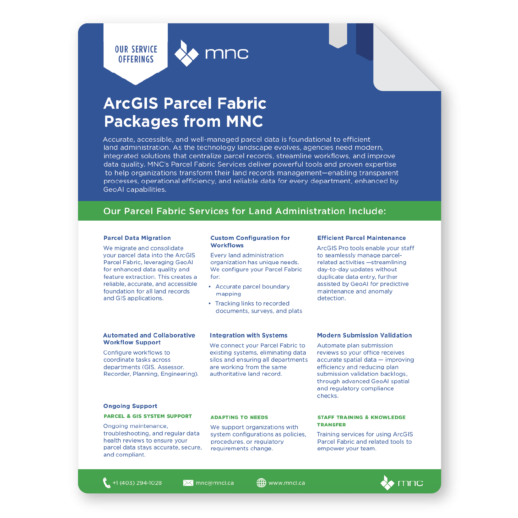
MNC Parcel Fabric Service Brochure Thumbnail

Why Parcel Fabric Services for Land Administration?

Modernize your land administration with accurate, authoritative parcel data that improves efficiency, reduces risk, and supports long-term system integrity.

Valued Outcomes

Deliver accurate, up-to-date property data to the public through continuous GeoAI-driven data quality improvements.
Streamline property tax assessment and land management processes.
Significantly reduce time and staff effort spent on parcel updates, splits, merges, and corrections through GeoAI-powered automation and anomaly detection.
Increase public trust in official land records and data management.
Gain proactive insights and predictive capabilities for land use planning and dispute resolution.
Enhance cross-departmental collaboration, auditing, and public transparency.
Automate complex data entry and validation tasks, freeing up staff for higher-value activities.

Frequently Asked Questions

What is ArcGIS Parcel Fabric?

ArcGIS Parcel Fabric is Esri's platform for managing a continuous, topologically correct digital record of all land parcels in a jurisdiction. It stores parcel boundaries, ownership links, survey plan history, and related land records in a single integrated database, replacing the fragmented shapefiles, CAD-based systems, and paper records that most land agencies still rely on today.  

A shapefile is a static snapshot of parcel boundaries with limited attribute data and no history. A parcel fabric is a dynamic, relationship-aware data model: it tracks the complete history of parcel changes over time, enforces topological rules so parcels share boundaries correctly with no gaps or overlaps, and links each parcel directly to its legal survey documentation.

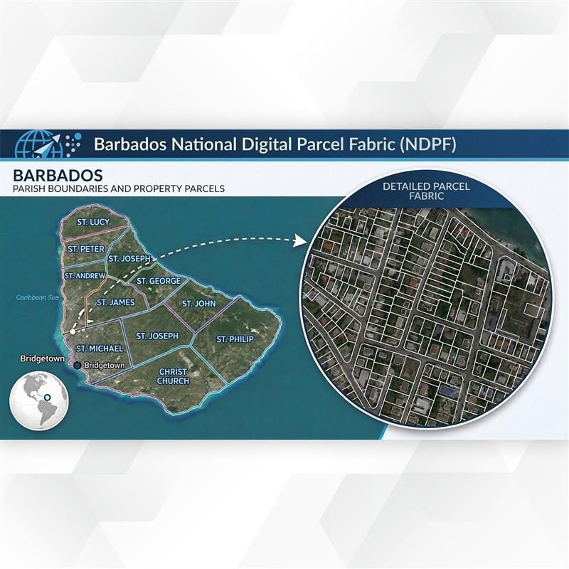
Timelines depend on the size and condition of your existing data. A focused municipal project typically takes 3 to 6 months; a provincial or national implementation, such as Alberta's Cadastral Program or the Barbados National Digital Parcel Fabric, spans 1 to 2 years. MNC provides a detailed project plan and realistic timeline following an initial needs assessment.

MNC has deep experience migrating data from paper survey plans, CAD drawings (including MicroStation and AutoCAD formats), legacy GIS files, and custom databases. The process involves document digitization, COGO entry or heads-up digitizing, and structured quality assurance at every stage to ensure spatial accuracy.

MNC uses a phased migration approach that allows your organization to keep operating on existing systems while the new parcel fabric is built alongside in parallel. A structured cutover plan, including a data freeze point, change reconciliation, and a staged go-live, ensures continuity of service and minimizes disruption.

MNC is the only Esri Parcel Management Specialty Partner in Canada. This designation is awarded by Esri to recognize demonstrated, verified expertise in deploying and managing ArcGIS Parcel Fabric solutions at scale. It means MNC has met Esri's highest standards for parcel fabric competency, giving clients confidence they are working with a proven specialist.

Combining parcel fabric modernization with an ArcGIS Pro migration in a single coordinated program is exactly what MNC recommends wherever both are needed. The data benefit is the key driver: doing both together replaces both the platform and the data model at once, reducing total cost and minimizing organizational disruption from two separate cutovers.

MNC has delivered parcel fabric projects internationally, including the National Digital Parcel Fabric for Barbados (124,000 parcels), consulting for Jamaica's National Land Agency, and the ParcelMap BC program, which earned an Esri SAG Award. MNC also provides parcel mapping services in the United States, including California and Florida.

→ Explore parcel fabric use cases: mncl.ca/use-cases/

→ Contact MNC to discuss your project: mncl.ca/contact/

Use Case Barbados NDPF

Use Case ParcelMap BC

Elevate Your Land Data With Trusted Geomatics Experts

From Parcel Fabric Modernization to seamless data migration,
MNC delivers reliable, on-time, and on budget solutions tailored to your
organization's needs. Let's build smarter systems together.