





Data Discovery and Assessment
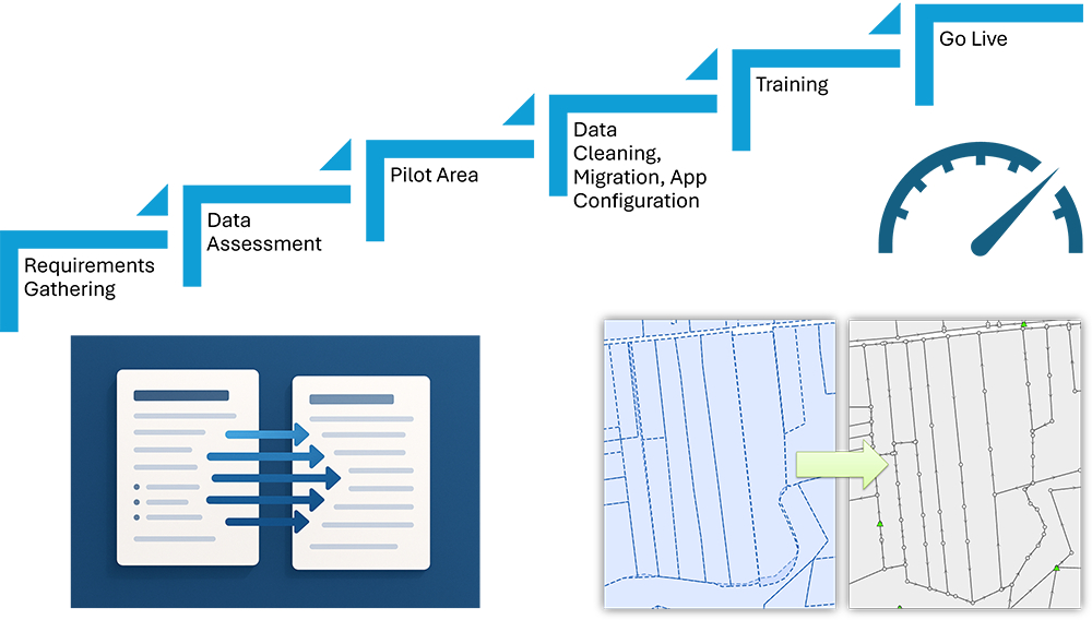
Inventory and evaluate existing and legacy data, leveraging GeoAI for automated spatial pattern recognition and anomaly detection, to define scope and migration needs with enhanced precision.
Data Transformation and Model Mapping
Align legacy data structures with new systems using precise mapping and transformation rules, enhanced by GeoAI for intelligent schema mapping and automated feature generalization.
Automated and Repeatable Migration Steps
Create efficient, traceable workflows to automate and streamline data migration, using GeoAI for real-time process monitoring and predictive conflict resolution.
Data Cleansing and Standardization
Eliminate duplicates and ensure consistency across all records through GeoAI-powered spatial data validation, automated correction, and intelligent attribute standardization.
Quality Assurance and Validation
Verify data accuracy, completeness, and compliance through thorough QA/QC checks, bolstered by GeoAI for predictive anomaly detection and advanced automated validation.
Metadata and Documentation
Produce detailed metadata and documentation to support governance and audits, using GeoAI for automated, spatially-aware metadata generation.
Ongoing/Term-Based Data Maintenance and Support
Maintain data quality post-migration through ongoing or scheduled support, applying GeoAI for continuous, proactive quality monitoring and predictive maintenance.
Securely migrate and modernize your land records with automated, GeoAI-enhanced workflows. Minimize risk and unlock powerful analytics.
Discover practical applications of MNC’s expertise
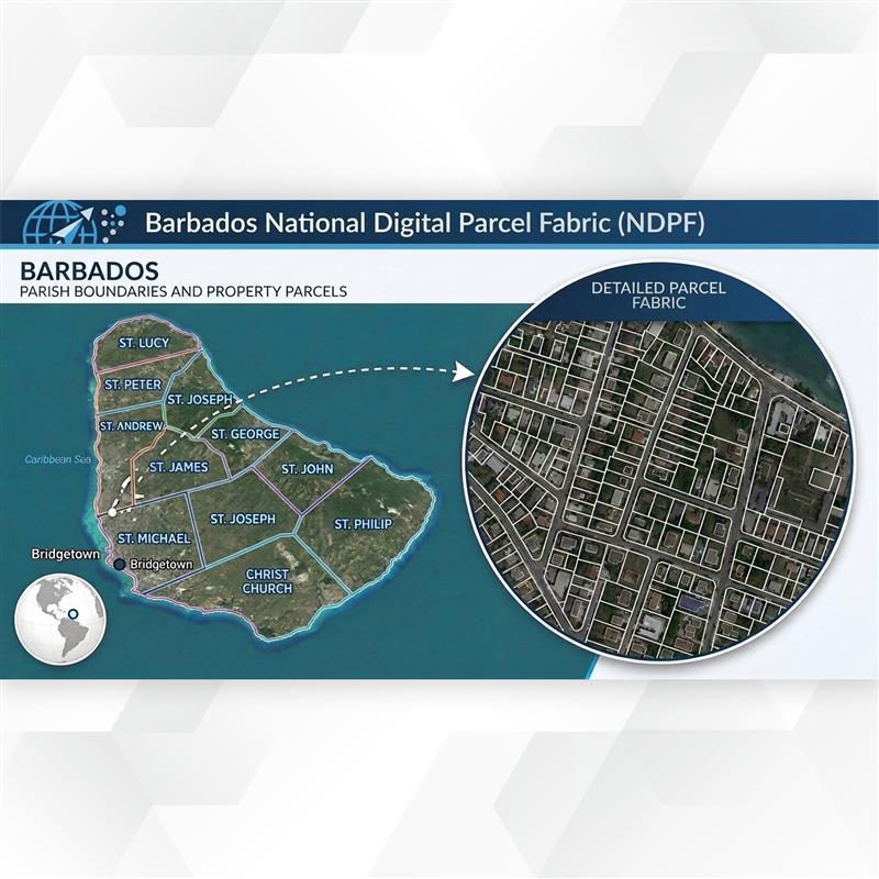
Collaborating with MNC has been an excellent process for us. MNC’s project management and clear communication approach made it easy for us to evaluate options and make informed decisions. They were quick to problem-solve and let us know the options and the impact of each.
MICHELLE ST. CLAIR, Project Lead, Barbados Lands & Surveys Department
MNC’s expertise has resolved complex data alignment issues and prepared us for future parcel mapping challenges. MNC’s tailored solutions and strategic insights have significantly improved our service delivery, ensuring that our Ontario Parcel information remains reliable. Their commitment to excellence resonates well with our goals at Teranet, making this collaboration a key component of our success.
![]()
David Hendry, Senior Manager, Ontario Parcel at Teranet
The efficient and timely compilation and maintenance of our data products is key to ensuring that our stakeholders receive the data they need for critical business decisions. MNC has proven for over twenty-five years that they are able to provide this service through their engagement as a contractor to the ADP-Altalis Joint Venture.

Erik Holmund, Executive Director at Alberta Data Partnership Ltd.
Data conversion transforms data from one format or structure into another. Data migration is the broader process of moving data from one system to another, encompassing conversion, quality assurance, validation, and a managed go-live. Both are typically required together in a modernization project, and MNC plans and executes them as an integrated program.
A focused municipal or county migration with clean source data typically takes 3 to 6 months. A large-scale provincial migration, such as Alberta's 219,000-survey-plan integrations, which MNC has managed continuously since 1998, was completed within 1 year. MNC provides a detailed project schedule following the initial data discovery phase, with key milestones and quality gates built in.
MNC uses a parallel-run approach: the new system is built and tested while your existing system stays live. Data is frozen at a defined cutover point, transactions processed during the migration window are reconciled, and a staged go-live ensures your team transitions to the new system with minimal interruption.
MNC has migrated data from paper survey plans and scanned historical maps, CAD files (AutoCAD and MicroStation), legacy GIS formats (shapefiles, personal geodatabases, MapInfo), spreadsheets and Access databases, and custom land information systems. MNC's experience spans both spatial geometry and non-spatial land records across jurisdictions in Canada, the USA, and the Caribbean.
MNC applies a structured, multi-layer QA/QC process: automated validation checks for topological integrity and attribute completeness; visual inspection against source materials; reconciliation against authoritative documents; exception reports for every discrepancy; and a formal client sign-off before data moves to production. GeoAI-assisted anomaly detection adds an additional layer on large datasets.
MNC has extensive experience bridging legacy mainframe databases, custom land information systems, and non-standard data sources with modern ArcGIS environments, typically using FME to build a robust integration layer. This replaces brittle, manually-maintained synchronization processes with automated, validated pipelines.
→ Discuss your migration project: mncl.ca/contact/
→ Learn about FME Services: mncl.ca/services/fme-services/
From Parcel Fabric Modernization to seamless data migration,
MNC delivers reliable, on-time, and on budget solutions tailored to your
organization's needs. Let's build smarter systems together.