





Data Modelling and Database Design

MNC is dedicated to designing data models that are precise, reliable, and flexible, specifically tailored to meet the unique requirements of land administration organizations, with robust support for GeoAI and advanced analytics. By leveraging industry-leading tools and methodologies, we ensure that your land records, cadastral parcels, ownership, and rights information are accurately captured, structured, and integrated across all relevant systems and applications, laying the foundation for powerful GeoAI insights. We engineer and implement database designs optimized for complex spatial data and land records central to land administration, prepared for the demands of GeoAI workloads.

Our Data Modelling and Database Design Services Include:

Selection of the Ideal Geospatial Database

We assess and recommend the most suitable spatially enabled database management systems such as Esri ArcGIS® Enterprise, PostGIS, or similar solutions to best fit your current and anticipated business needs, including future GeoAI and advanced analytics requirements.

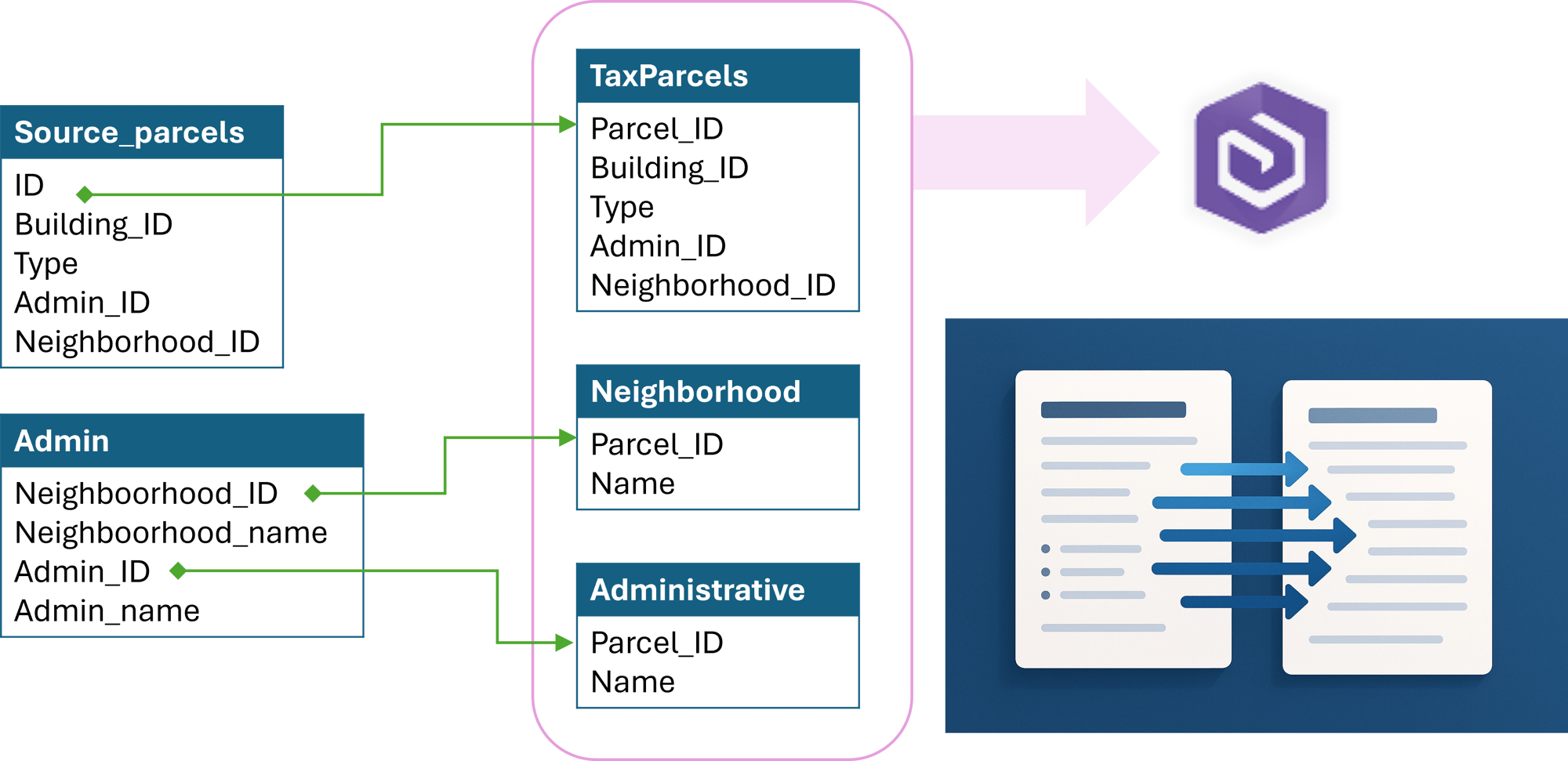
Data Model Service Image
MNC Data Modelling & Database Design Service Brochure Thumbnail

Why Data Modelling and Database Design?

Download our brochure to learn how MNC builds GeoAI‑ready, secure parcel databases.

Valued Outcomes

Optimized data structure to support all land administration requirements and advanced GeoAI applications.
Enhanced data integrity, reliability, and traceability supported by GeoAI-powered validation.
Improved operational efficiency and system performance for demanding GeoAI workloads.
Future-ready scalability for growth and evolving demands, including new GeoAI capabilities.
Compliance with industry, technical, and regulatory standards.
Greater data security, privacy, and audit capability.
Reduced maintenance burden and cost of ownership through intelligent GeoAI automation.
Increased stakeholder and public confidence in official records.

Frequently Asked Questions

What is geospatial data modelling?

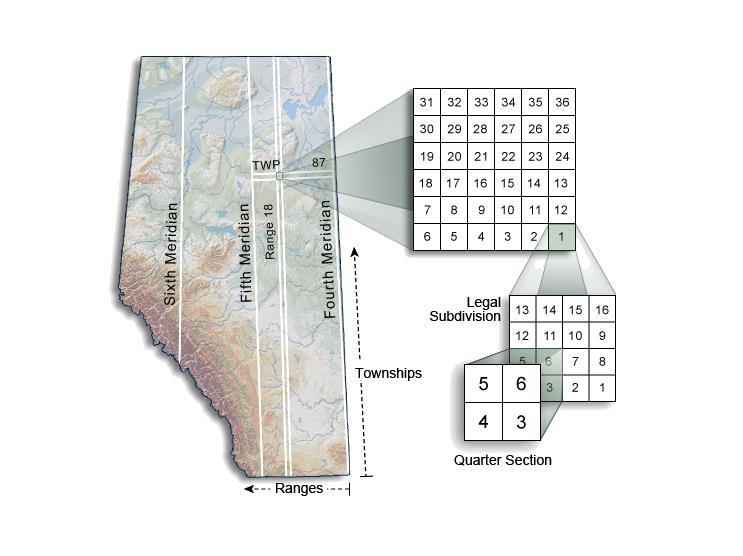
Geospatial data modelling is the process of designing the structure of a spatial database, defining what types of data will be stored, how they relate to each other, what rules govern their accuracy, and how they will be organized for efficient use. For land administration, this includes parcels, boundaries, ownership records, survey history, and title information.

Land records carry legal weight; they underpin property ownership, taxation, and land governance decisions. A poorly designed schema introduces ambiguity, complicates audits, and creates barriers to system integration that compound over time. A well-designed schema ensures data integrity, supports regulatory compliance, and makes your land records reliable enough for AI-driven workflows.

A GeoAI-ready data model is standardized, consistently attributed, topologically correct, and structured in a format that machine learning and AI tools can ingest without significant pre-processing. This means enforcing attribute domains and validation rules, eliminating inconsistencies, and following recognized spatial data standards. Most land administration databases require targeted remediation before they are ready for AI-driven workflows.

MNC designs and implements spatial databases on Esri ArcGIS Enterprise (including the geodatabase format), PostGIS (an open-source spatial database extension for PostgreSQL), and other spatially enabled systems. MNC assesses your current technology environment, security requirements, and long-term strategy before recommending a platform.

MNC regularly undertakes schema modernization projects where existing data is mapped to a new, improved model and migrated with full quality assurance. The process includes a detailed mapping specification, transformation logic built and tested, validation testing against agreed quality rules, and rollback planning to protect your existing records at every stage. 

A well-structured database reduces the need for manual corrections, simplifies system integration, and makes it easier to onboard new staff and tools. Poor schema design creates compounding technical debt, errors propagate through downstream systems, reports become unreliable, and every new integration becomes progressively harder. MNC designs for long-term maintainability from day one.

→ Discuss your data model requirements: mncl.ca/contact/

→ Learn about GeoAI readiness: mncl.ca/geoai/


Elevate Your Land Data With Trusted Geomatics Experts

From Parcel Fabric Modernization to seamless data migration,
MNC delivers reliable, on-time, and on budget solutions tailored to your
organization's needs. Let's build smarter systems together.