2002: Alberta Land Title Mapping
After the cadastral process was re-engineered (in 1998) and was in production mode, it was clear that the next logical step was to build a GIS-ready “parcel” dataset for every ownership title in Alberta. In just two and a half years, over one million titles were mapped using Bentley (MicroStation) and Esri (ArcGIS) Software. The new title mapping dataset was available on a province-wide basis in 2005. MNC continues to maintain this dataset today, over 19 years after the build containing over 1.6 million titles.
The Challenge
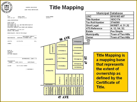
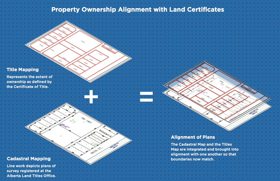
There was nothing that existed that showed a spatial representation of the extent of Titles registered in Alberta. Instead, users had to read and understand the legal description on each Title in order to identify the location that each Title covered. There was a growing need in industry for this data.
The Solution
MNC built a database containing the Land Identification Number Code (LINC) and legal description for each Title. Historical textual metes and bounds descriptions were also converted into a graphical format. MNC integrated this information into the Cadastral Mapping base and built ownership polygons based on the “extent” of Title.
The Results
- The Title mapping initiative was completed by MNC six months ahead of schedule and $600,000 under-budget, meeting all stated objectives.
- By 2005, it was clear the Title mapping initiative was a major success and justified the risk and investment. The majority of municipalities, both large and small throughout the province, were using the data and many private sector entities (developers, land agents, utilities, and resource companies) were subscribing to the dataset.
- A standard, authoritative Title mapping product was created.
- Redundant mapping activities were eliminated.
- An affordable province-wide Title mapping product became available to all municipalities.