2011: Community and Regional Planning Assessment Fabric Conversion
The Challenge
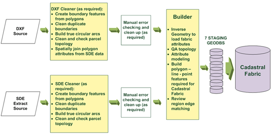
Manitoba Community and Regional Planning Assessment source data was being maintained by various source data providers in CAD and GIS formats. The province’s goal was to model these disparate datasets into a single parcel fabric for assessment purposes so that the geometry quality conformed to Esri (ArcGIS) Parcel Fabric rules and the attribution was correct, consistent, and complete.
![]()
The Solution
MNC acquired, analyzed, converted, cleaned, and migrated over 347,000 parcels from 196 datasets, both CAD and GIS shapefiles, into Esri’s Parcel Fabric data model.
The Results
Manitoba Community and Regional Planning Assessment now had a single parcel fabric in Esri format to use for assessment purposes that was correct, consistent and complete, with accurate attribution.