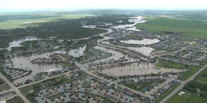
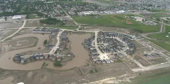
2013: High River Flood Relief
To assist in the recovery from devastating floods that struck the Town of High River, Alberta in June 2013, Tervita Corporation subcontracted Team MNC-Silvacom to develop the Assessment Tracker solution and provide GIS services. Tervita was contracted by the Government of Alberta (GoA) to handle the assessment and remediation for the Town of High River. Team MNC-Silvacom was engaged by Tervita to assist in immediate GIS support and data management for the relief effort. Team MNC-Silvacom was also tasked with developing an application to help complete on-ground property assessments and to organize the remediation efforts.
The Challenge
Tervita needed additional support To assist the Government of Alberta, insurance companies and the Town of High River in compiling, organizing and sharing data related to private and public assets in the Town of High River, in the aftermath of the floods
The Solution
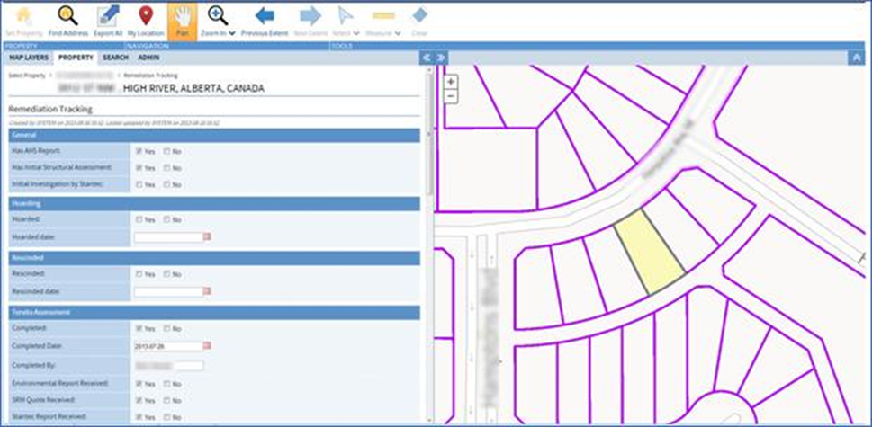
MNC collaborated with Tervita and provided the required GIS support and data entry for the Town of High River. Silvacom’s built a web application (Esri’s ArcGIS Platform) that provided a centralized location for the collection, storage and retrieval of various types of property information.
The Results
Map generation of recovery status and integration of other operational layers and base maps was facilitated using spatial data. Specific data requirements and workflows were integrated to assist ground-level recovery work. The final solution provided a spatial interface with forms and other controls that supported supervisors within the command office and crews using iPads, going door-to-door in the field to locate properties using a map-based viewer, assess damage, connect reclamation crews and coordinate with other departments or agencies.