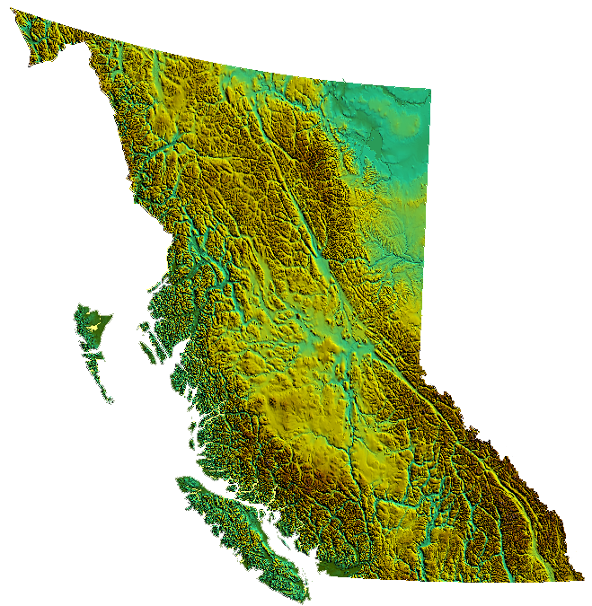
2017: ParcelMap BC
MNC created a single, complete, trusted and sustainable spatial GIS representation of the over 2 million active titled parcels and surveyed provincial Crown land parcels for the Land Title and Survey Authority of British Columbia (LTSA). The success of the project was shared at the Esri User Conference in San Diego in 2017, where LTSA received the Special Achievement in GIS (SAG) award for ParcelMap BC.
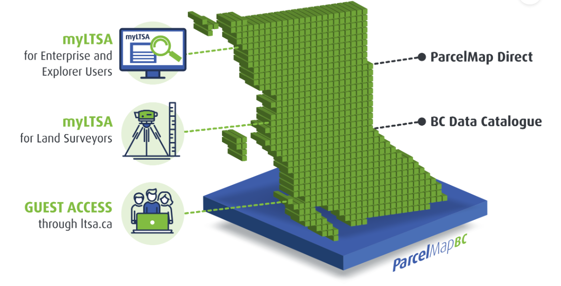
5 primary channels for customers to access ParcelMap BC:
- Lawyers, notaries, realtors and government staff use ParcelMap BC via myLTSA for land records research
- Land surveyors access ParcelMap BC for research, planning, and to submit survey plan datasets
- Property owners search ParcelMap BC through the LTSA’s website
- Stakeholders integrate ParcelMap BC with their systems using ParcelMap Direct
- GIS professionals use an Open Government view via the BC Data Catalogue
The LTSA was one of 180 organizations in areas such as agriculture, defense, transportation, nonprofit work, telecommunications, and local and state government to receive a SAG Award. Esri staff annually nominate hundreds of candidates from around the world for consideration, and Dangermond selects the finalists.Learn more about ParcelMap BC and how the LTSA is innovating through the application of GIS.
”The SAG Awards provide a great opportunity to showcase all the outstanding achievements of our users,” said Jack Dangermond, Esri founder and president.
“The Special Achievement in GIS Award recognizes exemplary organizations implementing spatial analytics technology to change the world. Highlighting the good work of users—in industries ranging from commerce to government—benefits the entire GIS community, and that’s very valuable.” Alex Miller and Myron Doherty of Esri Canada; Jack Dangermond, Esri Founder and President; Mike Thomson and Brian Greening of the LTSAParcelMap BC
“We gratefully acknowledge the contributions of our various partners to complete this ambitious project. The initial build of ParcelMap BC now offers a sustainable mapping infrastructure that unifies and standardizes parcel information, enabling everyone to access and benefit from land information in British Columbia.” said Connie Fair, President and CEO of the LTSA.
“MNC compilation work, assisted by ArcGIS desktop and mobile solutions, proved to be of excellent quality even under very aggressive deadlines and within the budget envelope.” Mike Thomson, British Columbia Land Survey, Surveyor General of British Columbia
The Challenge
The Land Title and Survey Authority of British Columbia (LTSA) is a publicly accountable government corporation responsible for administering the land title and survey systems in British Columbia (BC). Stakeholder demand for an easy, efficient means of accessing land title and survey information using an electronic map of surveyed parcels in BC has been a longstanding need. Intuitive map-based access to this information improves business efficiencies for government and private industry, and provides value to the general public.

The Solution
LTSA conducted a procurement process and subsequently contracted MNC (as part of the winning bid team including Esri and MDA) to compile and complete their parcel fabric. Esri’s parcel fabric data model was selected as the preferred data model and maintenance tool set for the LTSA operations team because it is a widely adopted Commercial Off-The-Shelf (COTS) solution and secondly, it supports the use of Least Squares Adjustments (LSA) to improve the fabric’s spatial accuracy.
The Results
MNC’s major project components:
- Field CAD Tie Collection: MNC developed an online and mobile solution for Cadastral Tie Survey (CATS) field data collection of approximately 2,600 cadastral field ties. FME workspaces were built to support the data migration and conversion from XLS to GIS features. 4,500 more ties were collected from registered survey plans. All ties were then integrated into the parcel fabric and used for spatial accuracy assessments and LSA.
- Esri’s Parcel Fabric: Created an Esri parcel fabric of every active titled parcel and surveyed provincial Crown land parcel within the Province of BC (approximately 2 million parcels). This fabric was compiled from disparate source datasets and completed with the precision input of over 10,000 missing parcels from survey plans and legal metes and bounds descriptions. 54 unique FME workspaces were developed for acceptance testing.
- Survey Plan Submissions (SPS) Website (released in 2016): Created a CAD specification and a web-based digital plan submission and checking system through which BC Land Surveyors submit their survey plan datasets. The CAD files and survey plan images are checked against LTSA business rules before submission and approval. MNC designed and built FME workspaces that are used to check and ensure data quality.