2017: Registered Interests on Titled Land (RITL) Benchmark Project
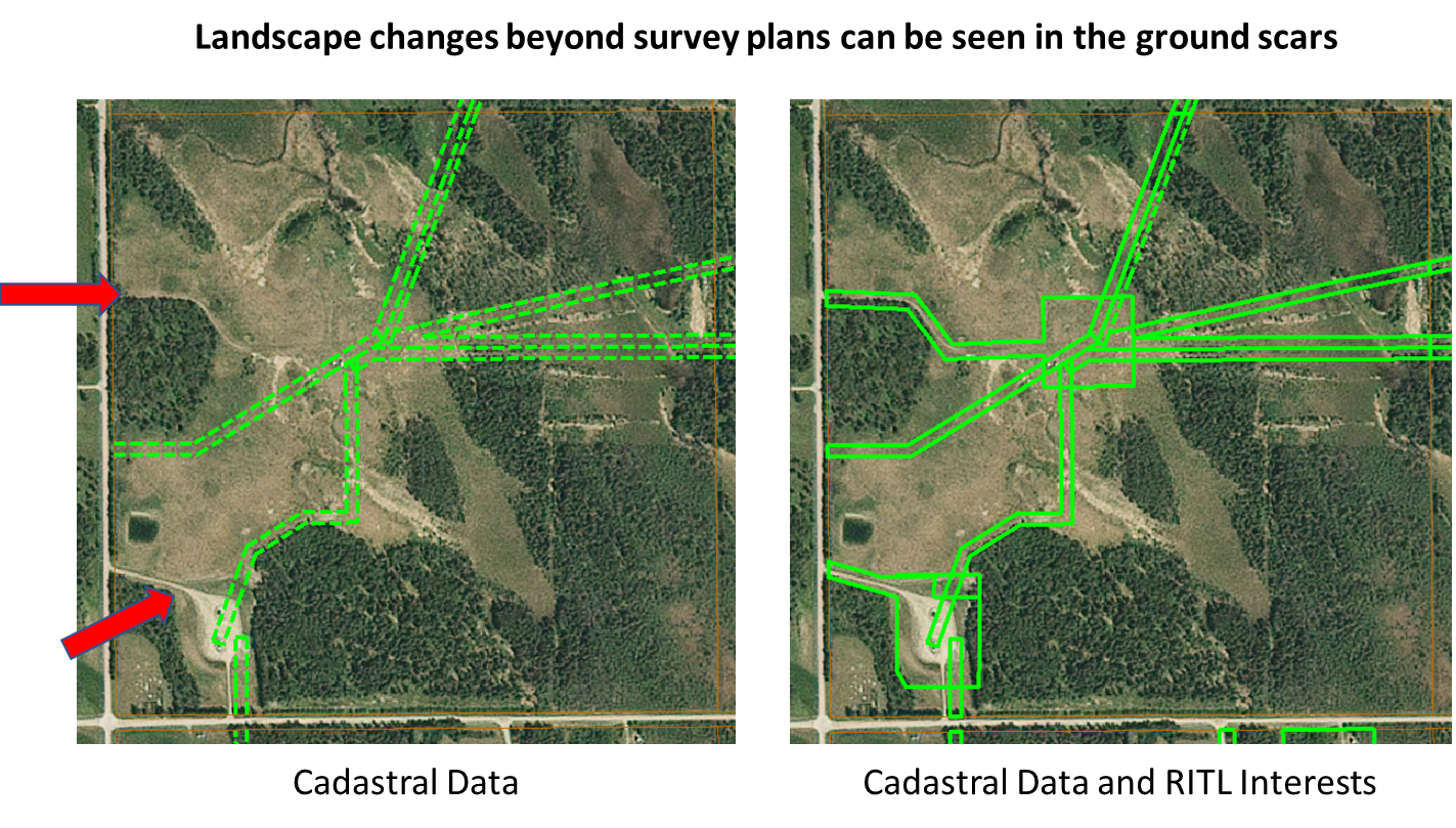
The RITL concept is described as the visualization of interests present on an Alberta Land Title certificate which has a spatial reference including Caveats, Right of Ways, Restricted Covenants and Easements, Discharges, Surface Rights, and Rights of Entry. There is currently no spatial record of surface activities (interests) on private lands unless they are shown on registered plans of survey.
In 2017, MNC completed a Benchmark Project using Esri (ArcGIS) software, which proved the viability of the RITL mapping initiative.
The Challenge
There is no spatial record of surface activities (interests) on private lands unless they are shown on registered plans of survey. Industry requires a dataset showing the spatial extents of Caveats, Right of Ways, Restricted Covenants and Easements, Discharges, Surface Rights, and Rights of Entry.
The Solution
For this benchmark project, all caveats, utility rights of ways, restricted covenants and easements were mapped within a single Alberta township. The intent was to develop a baseline mapping representation to enable further engagement and discussion with end users. It has since been used to support engagement in discussions with Government and industry stakeholders.
The Results
By developing a baseline mapping representation to enable further engagement and discussion with end users; ADP has effectively used this Benchmark Project to support engagement in discussions with government, municipal, and industry stakeholders.