2018: CAD to GIS Data Cleanse and Spatial Viewer Web Map
![]()
The Challenge
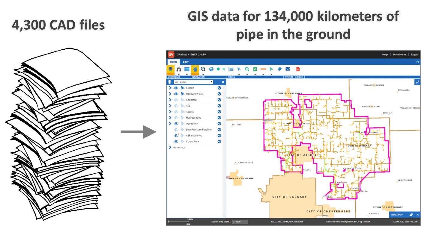
The Federation represents over 123,000 customers in Rural Alberta through a system of 52 local natural gas distribution co-operatives, six (6) Counties, 16 Towns and Villages, and seven (7) First Nations systems. This system has over 134,000 kilometers of pipe in the ground.
Changing requirements and standards have led to inconsistencies in The Federation’s spatial data. The current data is not spatially accurate or complete enough; nor is it in GIS format.
The Solution
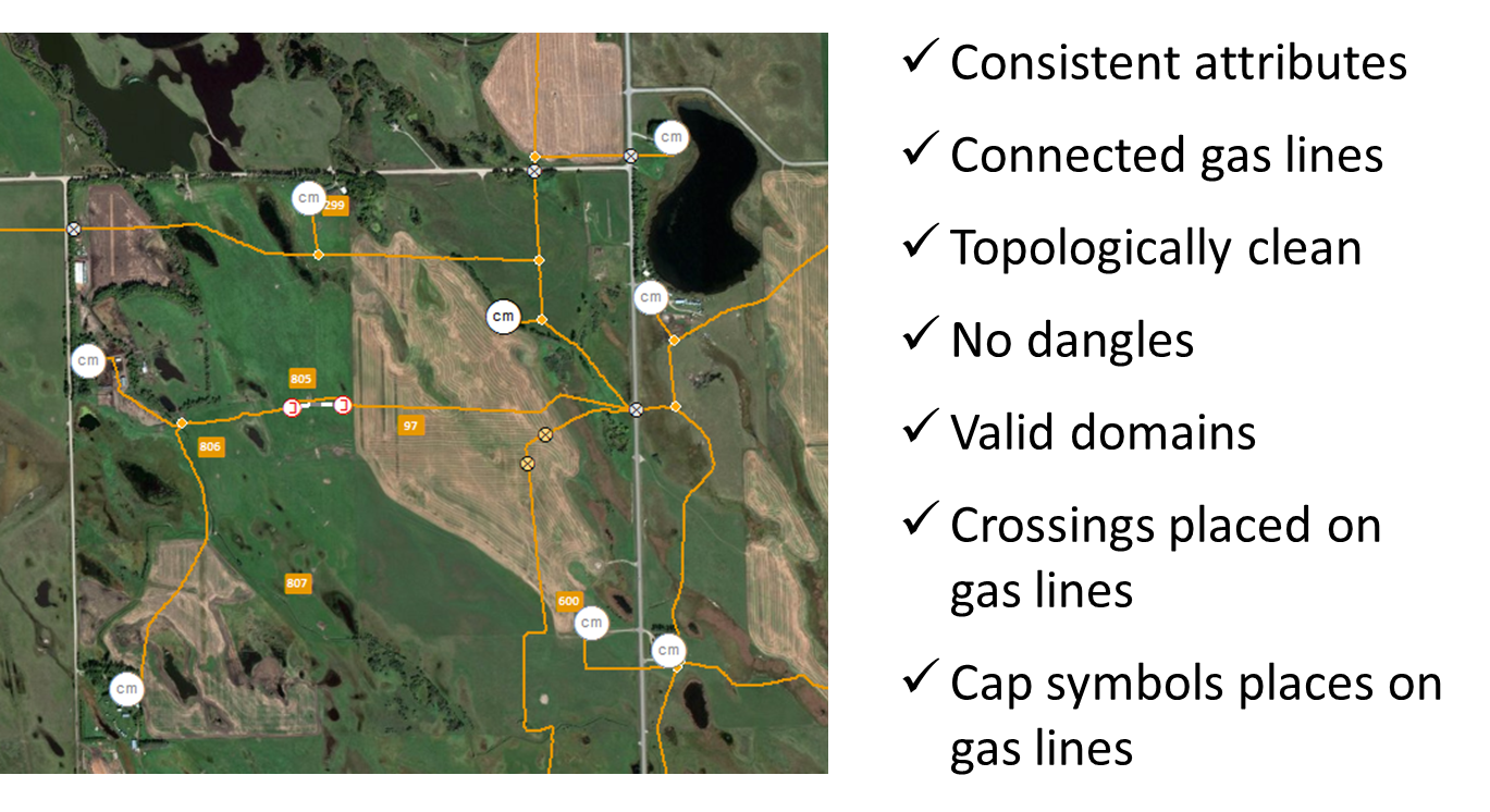
MNC performed a data cleanse of all gas line pipelines, underground infrastructure and above ground infrastructure, and created a fully connected, GIS-ready mapping model, using Esri (ArcGIS) software.
Editing and data maintenance was also made available through the deployment of Spatial Viewer; a web mapping application with robust built-in capabilities such as data visualization, editing, data uploads and the ability to create PDF map outputs.
The Results
Their data is now current, accurate and fully connected in a GIS format that is easily accessible for their team through the Spatial Viewer a web mapping application with robust built-in capabilities such as data visualization, editing, data uploads and the ability to create PDF map outputs.