2019: Nanaimo Parcel Fabric Geometry Replacement
After the ParcelMap BC parcel fabric became fully operational in 2017, it was discovered that a superior quality representation of the City of Nanaimo’s cadastre was available than was used in the ParcelMap BC initial build.

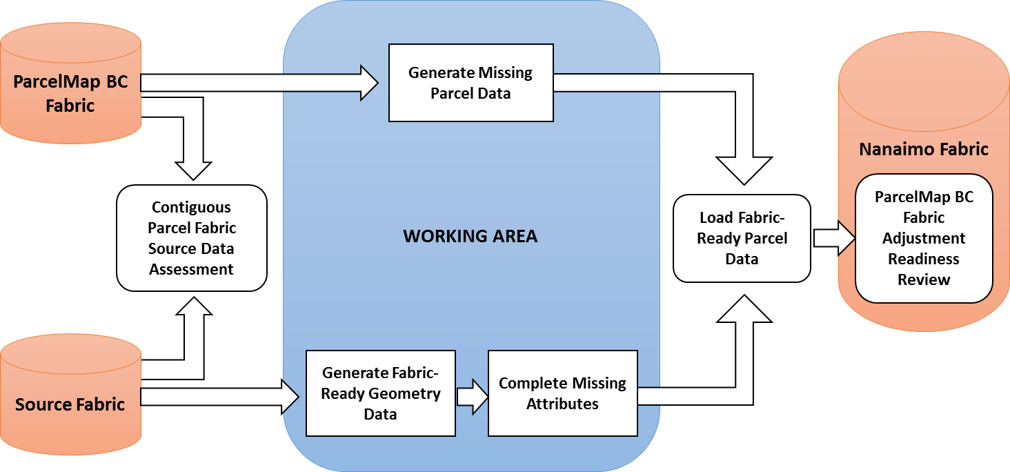
The Challenge
The City of Nanaimo’s parcel fabric representation greatly exceeds the spatial accuracy and precision of the parcel polygon geometry used for the initial build in ParcelMap BC; this discrepancy limits the ability of the City of Nanaimo and other users of parcel fabric representing the region to adopt ParcelMap BC.
The Solution
MNC was selected to provide Esri (ArcGIS) services under the Nanaimo Geometry Replacement project which resulted in the replacement of the ParcelMap BC fabric within in the City of Nanaimo geometry data with the recently recompiled data from the City of Nanaimo source parcel fabric to:
- Preserve the spatial accuracy and precision – represented by the survey dimensions captured within parcel boundaries, and
- Enhance the completeness of certain classes of parcels not originally in the compilation scope of ParcelMap BC as found in the parcel fabric maintained by the City of Nanaimo.
The Results
Replacing the ParcelMap BC data with current City of Nanaimo parcel fabric reduced the barrier for the City and other organizations consuming the parcel fabric in the region to help achieve the strategic objective off the LTSA.