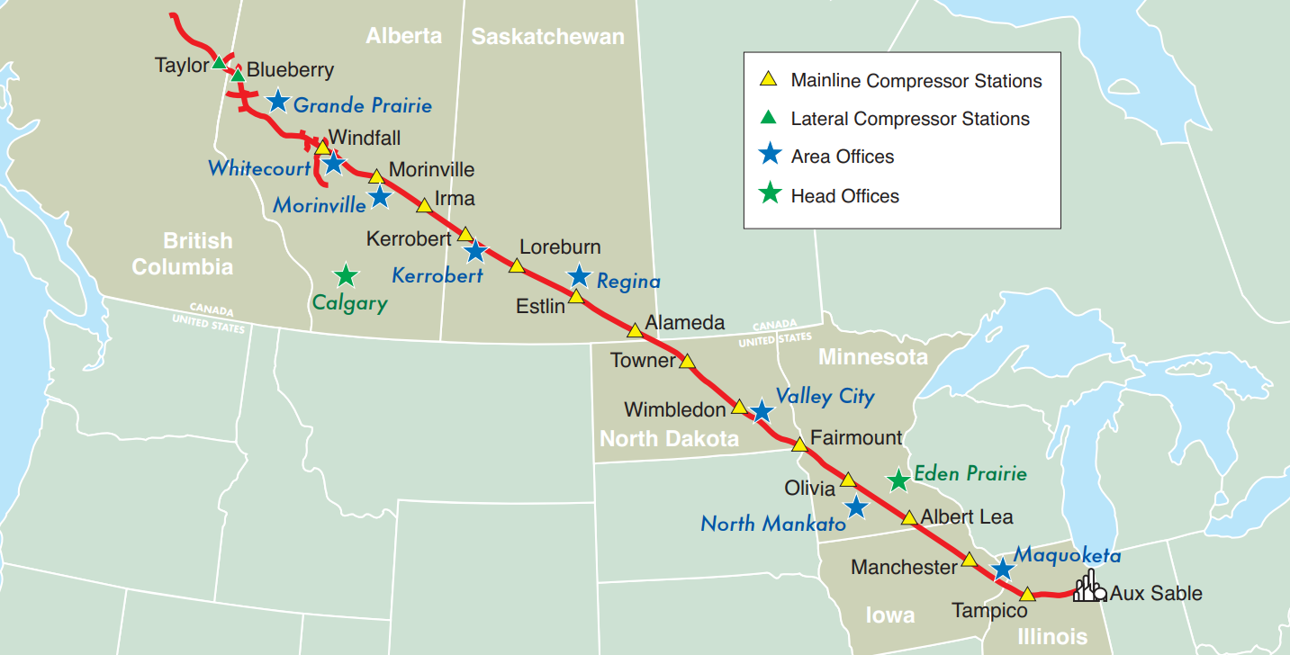
1998: Alliance Pipeline
This was MNC’s original venture into GIS, tackling a 2,391 mile (3,848 km) long natural gas pipeline for Alliance
![]()
The Challenge
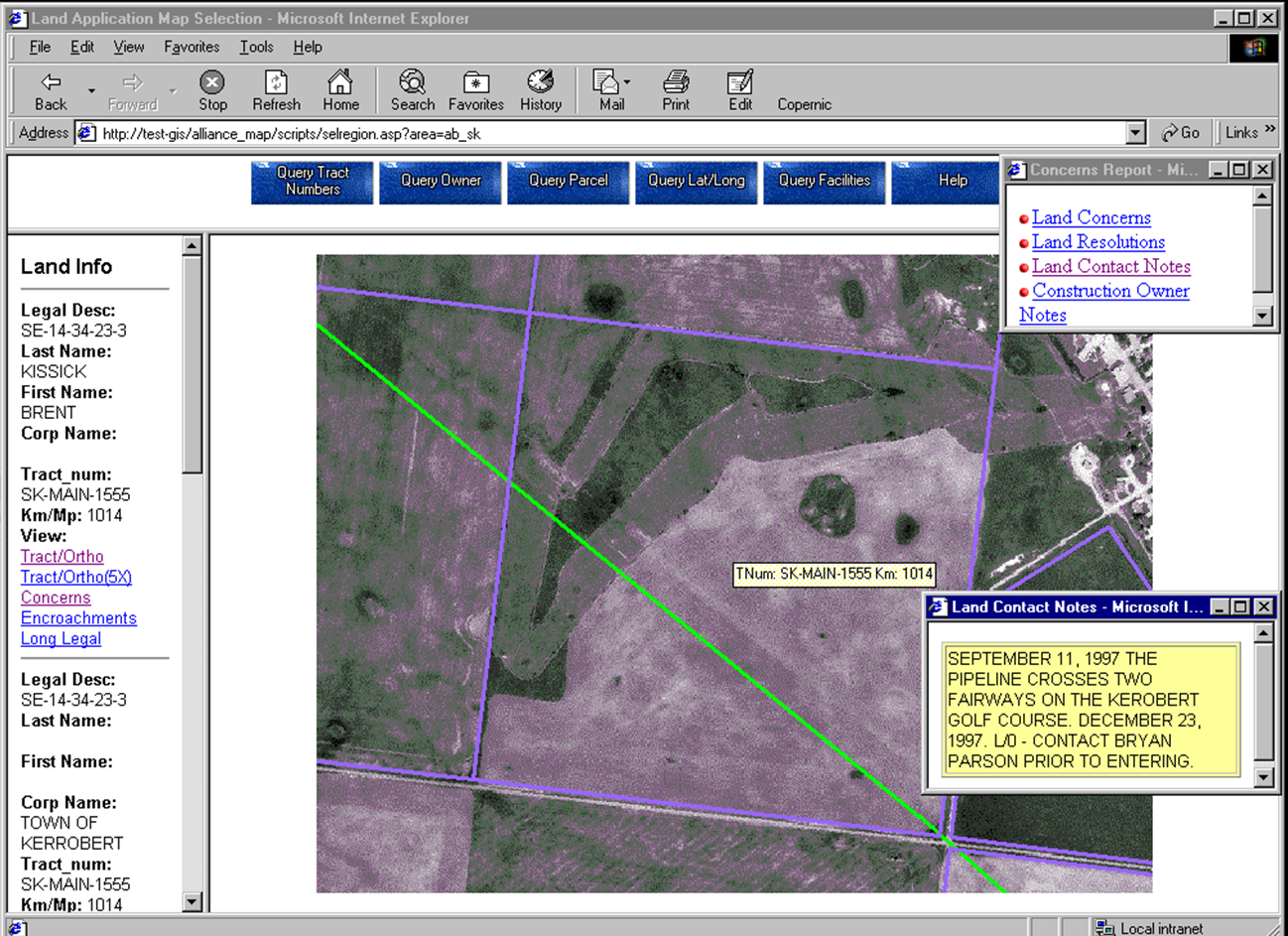
This project had thousands of documents from proposed to AS built CAD files in both Bentley (MicroStation) and AutoDesk (AutoCAD) formats for the pipe alignment and build, facility drawings, emergency plans, land applications etc., all of which were not easily accessible to the Team. They wanted a WEB GIS system that could house all the documents and plans with easy access and all spatial plans were to be geo-referenced
The Solution
MNC built a smart map integrating data from various sources providing access to all the documents and drawing files.
The Results
The Smart Map provided real time information about the project, which improved decision making and enhanced the user experience.